Bankfull Mean Depth to Drainage Area
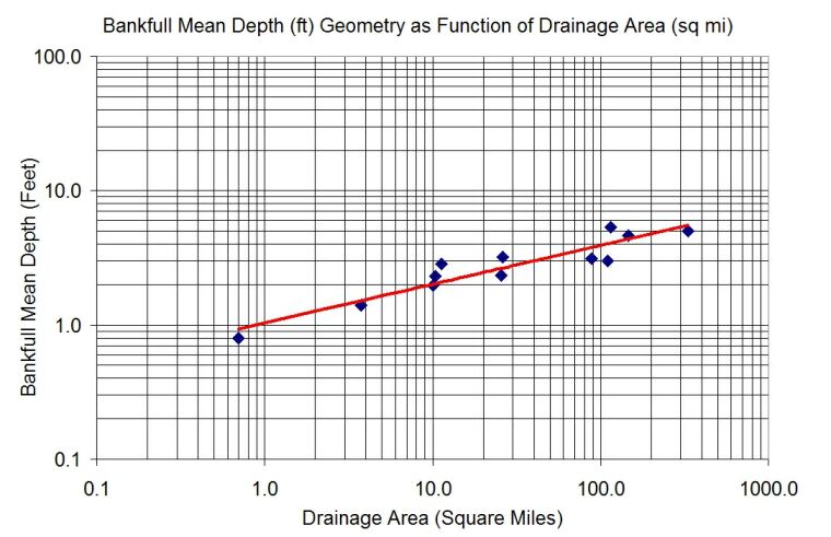
A graphical regression between Bankfull mean depth and drainage area is typically performed on a log-log plot. Bankfull mean depth is measured using techniques discussed earlier, typically at a representative riffle or some average riffle cross-section depth where Bankfull is readily determined. It is not the maximum depth at the Thalweg, but the average of many sectional depths. As would be expected, Bankfull mean depth typically increases with drainage area, but again, deviations exist within and between regions.
| 