
| glossary | menu | Normal | lg | hc | 7.) Classification and Channel Geometry Relations > Ouachita River Gauge Bankfull Stage |
| < Previous | 1 | 2 | 3 | 4 | 5 | 6 | 7 | 8 | 9 | 10 | 11 | 12 | 13 | 14 | 15 | 16 | 17 | 18 | 19 | 20 | 21 | 22 | 23 | 24 | 25 | 26 | 27 | Next > |
Ouachita River Gauge Bankfull Stage
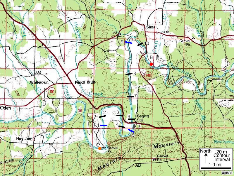
The Bankfull stage estimate should be recorded for future work in this exercise. This and other background data on the gage and channel come from the 12/13/2001 report by USGS employee J.S. Wallace.
BANKFULL STAGE: Bankfull stage is about 22.0 ft. The extreme low-water control is a gravel riffle 400 ft downstream of the gage. At medium low water, the control shifts upstream about 200 ft to a massive fractured bedrock outcrop that bisects the Stream . At higher stages, channel control is effective. All flow passes under bridge, except during extreme events.
In most Bankfull stage assessments, several locations are inventoried for Bankfull indicators. In this map the illustrated lines show the area where Bankfull may have been surveyed during a longitudinal profile. From this set of Bankfull measurements, the Bankfull height at the gage would be compared to check for deviation from the central tendency.
Image courtesy of USGS
| < Previous | 1 | 2 | 3 | 4 | 5 | 6 | 7 | 8 | 9 | 10 | 11 | 12 | 13 | 14 | 15 | 16 | 17 | 18 | 19 | 20 | 21 | 22 | 23 | 24 | 25 | 26 | 27 | Next > |