
| glossary | menu | Normal | lg | hc | 4.) Geomorphologic Classification Systems > Location #4 Exercise |
| < Previous | 1 | 2 | 3 | 4 | 5 | 6 | 7 | 8 | 9 | 10 | 11 | 12 | 13 | 14 | 15 | 16 | 17 | 18 | 19 | 20 | 21 | 22 | 23 | 24 | 25 | 26 | 27 | 28 | 29 | 30 | 31 | 32 | 33 | 34 | 35 | 36 | 37 | Next > |
Location #4 Exercise
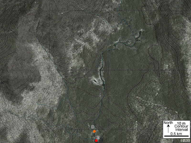
Exercise Objective
To apply various complimentary FGM based classifications to maps and imagery of Valley areas and river Reaches.
Exercise Process
Download and view maps and images for location #4.Consider and record how this location between D and E would be classified using the four systems below. Note that this Reach is immediately downstream of the Reach C to D in the earlier slide.
- Young, Mature and Old by Davis
- Stream Order by Strahler and Horton
- Straight, Meandering and Braided by Leopold, Wolman, Miller and Schumm
- Source, Transfer, and Depositional by Montgomery and Buffington
Revisit the classification schemes as described earlier in Section 4 if they are unclear.
Image courtesy of USGS
| < Previous | 1 | 2 | 3 | 4 | 5 | 6 | 7 | 8 | 9 | 10 | 11 | 12 | 13 | 14 | 15 | 16 | 17 | 18 | 19 | 20 | 21 | 22 | 23 | 24 | 25 | 26 | 27 | 28 | 29 | 30 | 31 | 32 | 33 | 34 | 35 | 36 | 37 | Next > |