Computing River Cross Sectional Area Exercise
Exercise Objective
To compute river cross sectional area through application of fluvial geomorphology terms and variables.
Exercise Process
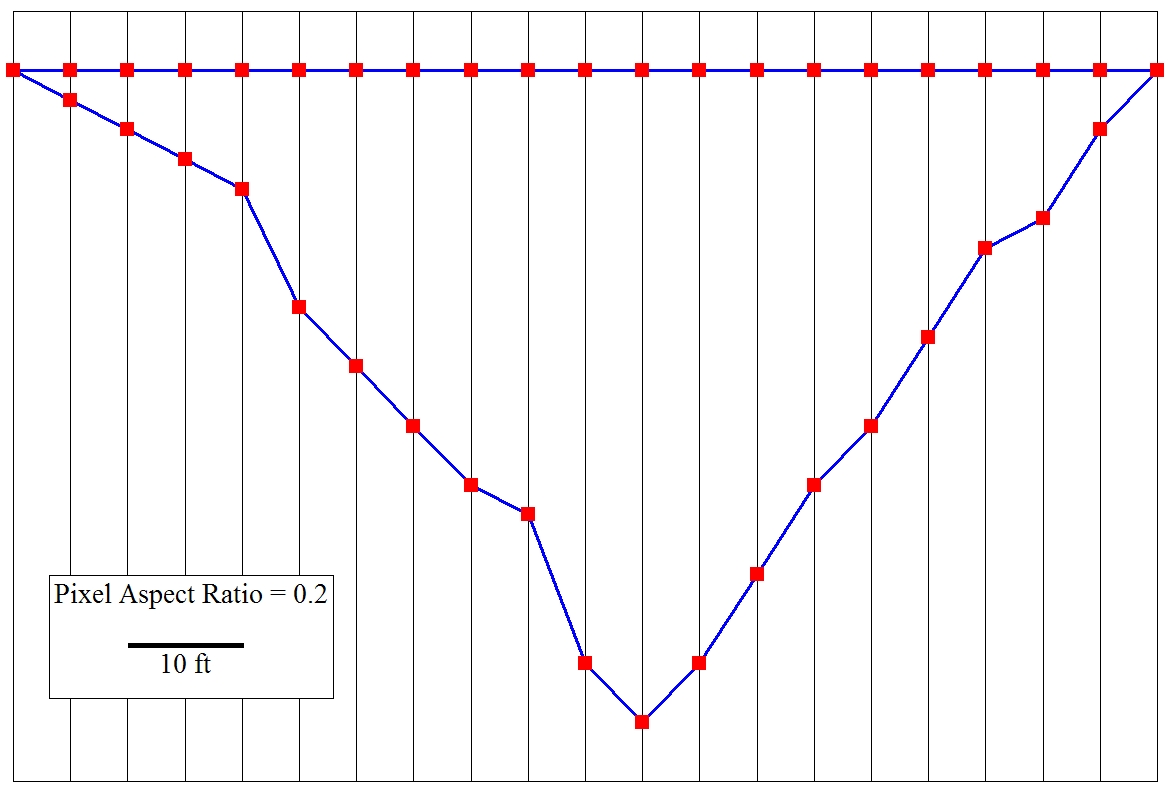
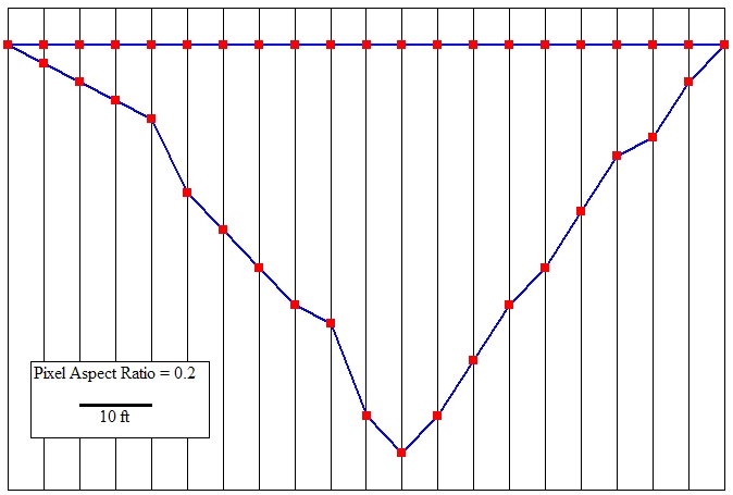
- A river's FGM dimension needs surveying to understand Bankfull flow and flood characteristics. The cross-section is shown in the picture on this page.
- Determine the river Bankfull cross sectional area using the formula given in Section 2. This will require values for mean Bankfull Depth and Bankfull Width.
- Launch ImageJ and open the 03_75_02.jpg cross section picture. The cross section picture shown on this page is a coarse resolution, and a higher resolution image is available by right clicking on the hyperlinked cross section picture to download the file 03_75_02.jpg. Save the image for later access with the ImageJ software. Instructions on how to use ImageJ were provided in Section 1 of the FGM Module.
- Set the scale for analysis of the cross section. The scale bar along the left base of cross section is for 10 feet distance, and can be used in ImageJ with the Straight line selections tool and the Set Scale window accessed from the Analyze toolbar. In the Set Scale window, the Pixel Aspect Ratio should be set to 0.2, indicating the vertical exaggeration of this picture.
- Compute Bankfull Width. Bankfull was determined in the field, and is denoted by the upper horizontal blue line, which extends the entire Bankfull Width. Based on the Bankfull extent, measure and record the Bankfull Width in feet.
- Compute mean Bankfull Depth. Mean Bankfull Depth is determined by using the formula given in Section 2. To determine this value, measure and record the vertical depth (in feet) at each of the 21 stationing increments, indicated by the vertical bars. Two of these vertical measurements, where Bankfull Depth intersects with the cross section profile, are at a vertical distance of 0. Once the sum of the 21 values is computed, determine and record the mean Bankfull Depth.
- Compute Bankfull cross sectional area. As indicated by the formula, this is the product of Bankfull Width and mean Bankfull Depth. You can check your work by using the ImageJ Polygon selections tool to directly measure in the cross sectional area. In field surveys, such direct area measurements are not typically feasible, so the method using mean Bankfull Depth is more traditional.
- Check your work on the next page.
|
Developed by